|
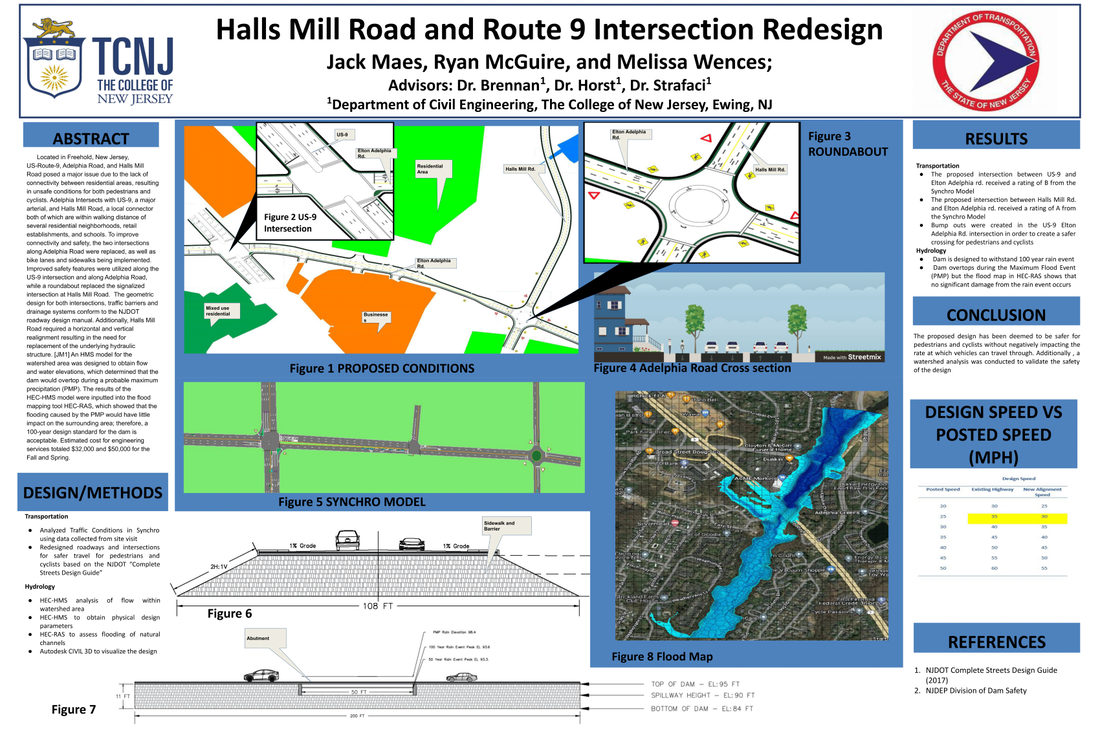
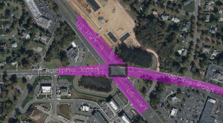
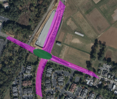
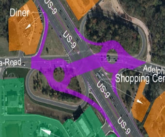
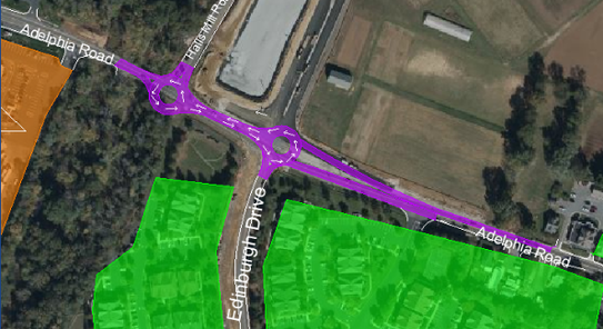
3/31/2023 0 Comments Hydrologic SpillwayThe New Jersey Department of Environmental Protection provides public data on Storage Elevation data. The storage volume is 0 at an elevation of 84 feet, indicating that the base of the dam will be at 84 feet. The transportation team determined that the road elevation at the site of the proposed dam is 95 feet, which means that the top of the dam will correspond to that elevation. The final parameter required to run the hydrologic model was the spillway width, which was determined using a mapping tool. 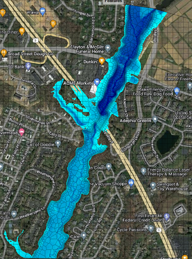 3/30/2023 0 Comments Roadway Improvements to Route US-9Route 9 was redesigned as a signalized intersection with sidewalk, bike lane, and buffer implementations throughout Route 9, Elton-Adelphia Road, and Halls Mill Road. The buffers are set to 3ft, and the bike lanes and sidewalks are 5ft wide. The signalized intersection improved the disconnectivity between the residential areas and local businesses by providing pedestrians with safe sidewalks and other means of transportation, such as biking, to get around the local area. Due to the new intersection redesign, the new design speed was set to 50 miles per hour. The redevelopment of the intersection is shown below. Using Synchro, a representation of the new redesign of Route 9, Elton-Adelphia Road, and Halls Mill Road was created. Based on the collected traffic counts, the design scored a rating of B, which means that the design has a positive impact on the overall goal of the project, which was to improve the disconnectivity of the intersections while providing safety for pedestrians and cyclists. The model of the overall design is shown below. 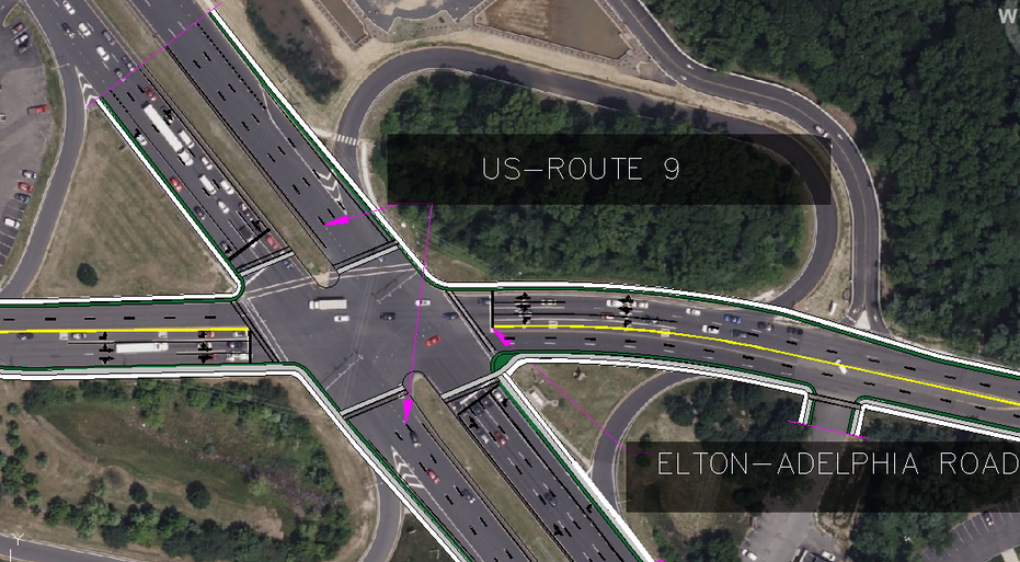 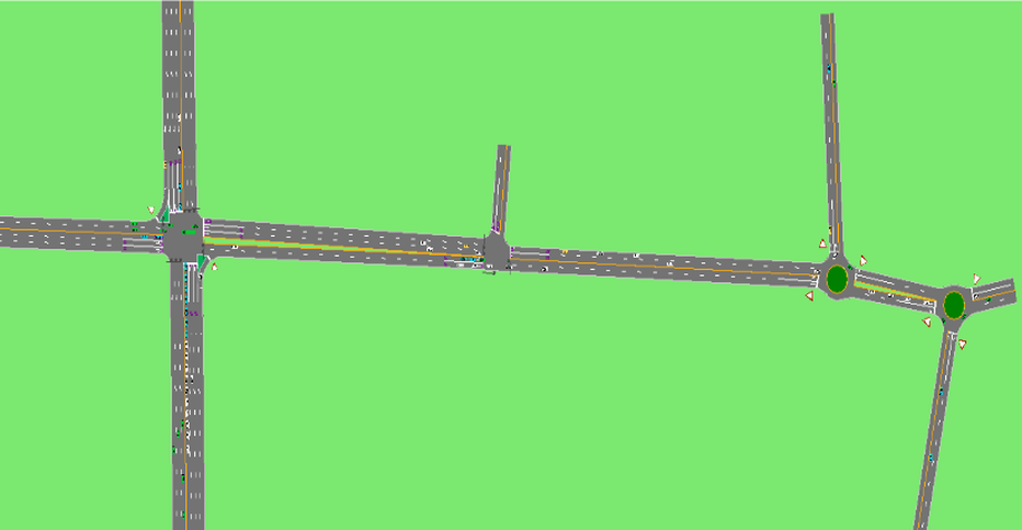 The figure below shows the final redesign of Halls Mill Road and Elton-Adelphia Road. The roundabout's redesign has improved traffic flow by eliminating traffic signals and replacing them with yield signs. Additionally, signalization for pedestrians and cyclists was implemented to enhance their safety. The roundabout was also designed to decrease accidents by forcing drivers to slow down when coming off Route 9 and onto Elton-Adelphia Road and Halls Mill Road. The new realignment of Halls Mill Road necessitated a new design speed limit of 30 miles per hour, and vehicles approaching the roundabout must slow down to 15 miles per hour to ensure pedestrian and cyclist safety. The roundabout's inner diameter is set at 80 ft, with each lane being 12 ft wide. 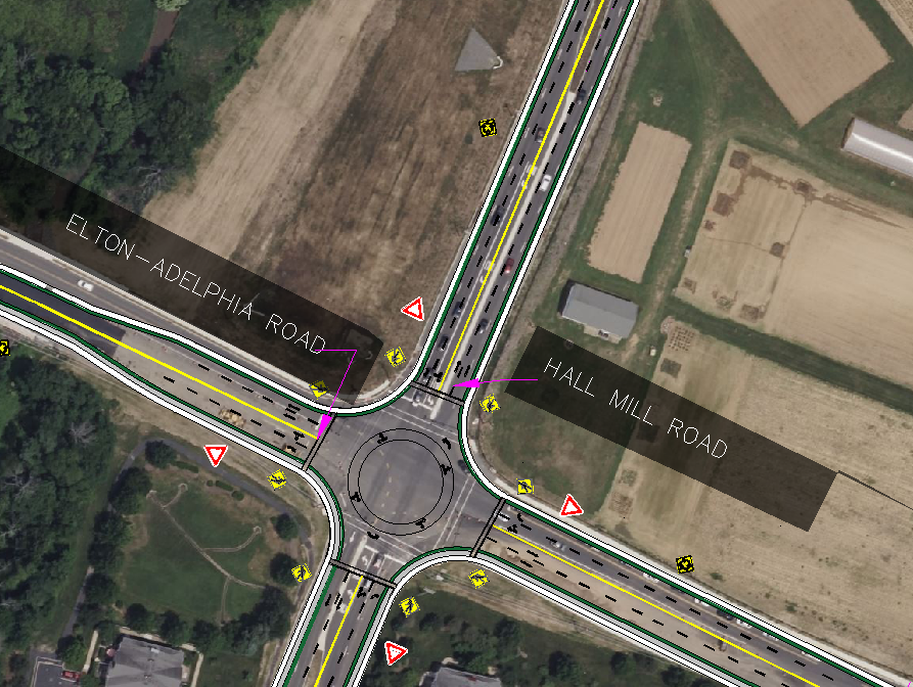 3/6/2023 0 Comments February Update Continued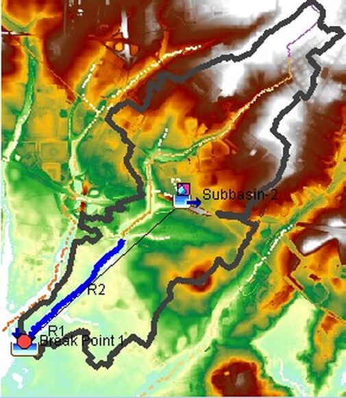 The team utilize the hydrology software HEC-HMS to run a Probable Maximum Precipitation (PMP) model in order to simulate the worst case flood our watershed area could possibly experience. This provided the team with a peak flow value, allowing us to begin the second half of the project. This semester, the physical elements of the dam must be designed. This includes the height of the dam, length of the spillway, potential outlet structures, and the basin size. In February 2023, research was conducted in order to discover the size of the basin. The size of the basin allows us to know the volume of the actual standing reservoir, which is the first part in determining the height of the dam. As of the beginning of March, the basin size has been identified and work will continue to design essential parameters of the final dam design.
The team created a surface representing the existing roadway conditions with respect to elevation. Alignments of Elton Adelphia Rd., Halls Mill Rd., and US-9 were then constructed over this surface to accurately represent the geometry of the roads. These alignments began at stationing 10+00 and increased from East to West and South to North, using the centerline of the roadways. To create a profile view of the roadway elevations, elevation shots were taken from Google Earth and inserted into AutoCAD Civil 3D. A centerline was created in the roadway using elevations from Google Earth, and a profile view was generated. Both the alignments and profile views of the roadways are shown below. 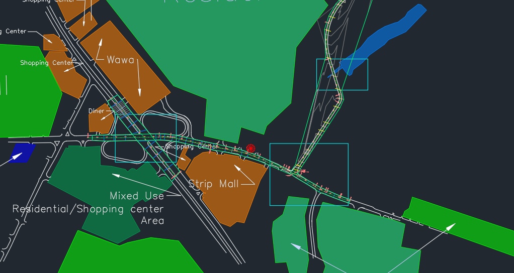 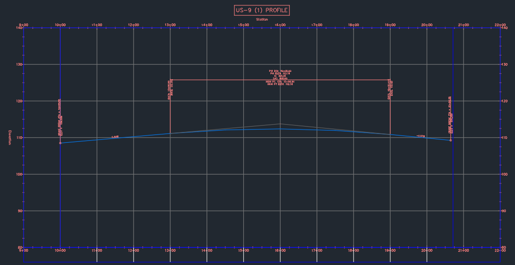 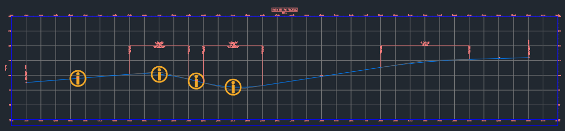 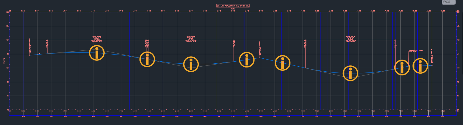 11/29/2022 0 Comments Web Soil Survey and Curve Number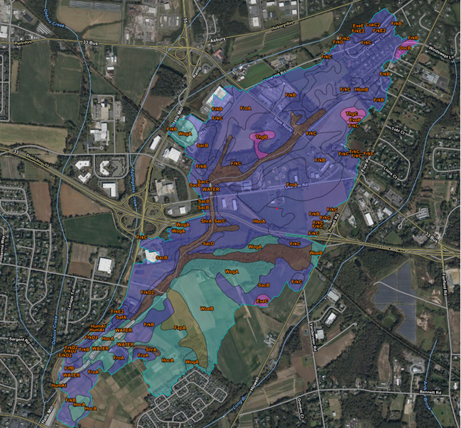 After obtaining the shapefile of Halls Mill Road's watershed area, a Web Soil Survey of the land can be completed. By utilizing websoilsurvey.sc.egov.usda.gov, the group can obtain a detailed breakdown of the soil types in the watershed area. The web soil survey provides a letter rating (from A-D) and an area breakdown of each individual section. By obtaining this data, we are able to find the Curve Number for the watershed area, which is the last parameter needed before running the HMS Model.
11/29/2022 0 Comments Hydrologic Parameters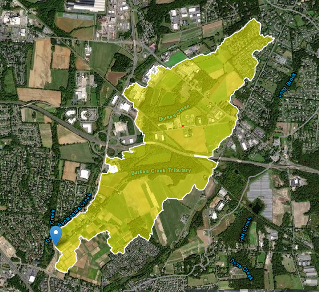 To begin the design of the proposed dam, the hydrologic parameters of the dam's watershed area must first be obtained. By utilizing the website streamstats.usga.gov, the group was able to delineate the given watershed area as well as obtain the area, slope, and longest hydraulic length of the system. Steam stats also provides the user with a shapefile of the area, which has multiple uses further down the road.
11/21/2022 0 Comments Synchro Analysis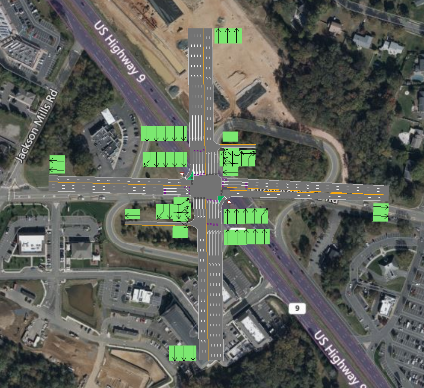 The group has begun to construct a synchro model (shown in Figure 3) in order to analyze the traffic that travels throughout the intersections. To effectively model the intersection, the roads were oriented in a true North-South and East-West direction. This streamlined the process without compromising the outcome.
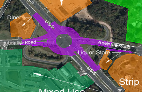
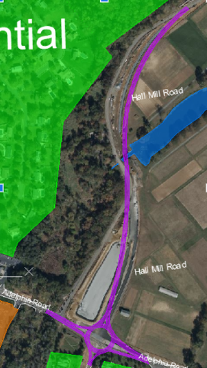
10/30/2022 0 Comments Alternative DesignsThe team has completed the preliminary design alternatives. Three total transportation redesigns were created, each with its own benefits and drawbacks. In the design process, a different perspective was used for all three iterations. The redesigns' main priority is safety. In some designs, the flow of traffic was held in higher regard than in the other designs, in which pedestrians' safety was prioritized to a degree that the flow of traffic was subsequently sacrificed. Both sidewalks and bike lanes are included in all three redesigns, although they are not visible in the drawings. Sidewalks and bike lanes are a priority in the overall redesign to improve and implement more connectivity within the residential areas and local businesses Alternative 1: RoundaboutsThe first alternative design for the intersections consists of utilizing a roundabout at both HWY US-9 and Halls Mill Road, as well as at Adelphia Road, as shown in Figure 1.4 and Figure 1.5. The emphasis of this intersection is to create a safer environment without sacrificing the rate at which traffic will flow. Figure 1.5 shows the Halls Mill Road and Adelphia Road intersection, and Halls Mill Road was also realigned to provide a safer curve and allow the road to intersect into the roundabout. Islands are going to be designed for pedestrians and bicyclists at the intersection of HWY US-9 and Adelphia Road. The islands will allow for a safer crossing while also allowing traffic flow to continue unimpeded. Alternative 2: Roundabout & Square IntersectionFigure 2.1 and Figure 2.2 represent the second alternative redesign. Figure 2.1 shows a square intersection designed for HWY US-9 to control traffic flow and implement sidewalks and bike lanes for local pedestrians who want to travel to nearby stores. Figure 2.2 displays a roundabout with an island replacing the existing design that does not have pedestrian access. The main goal of the second design was to create intersections that slow down traffic on HWY US-9 and allow safer pedestrian and bike travel along these roads. The Halls Mill Road intersection would prevent traffic congestion buildups. Both Figure 2.1 and 2.2 prioritize slower travel for vehicles.
|