|
11/29/2022 0 Comments Web Soil Survey and Curve Number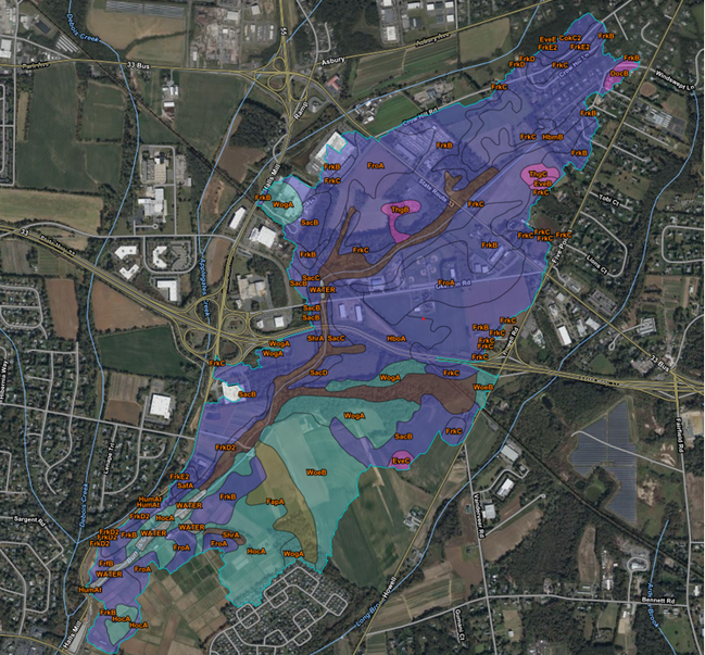 After obtaining the shapefile of Halls Mill Road's watershed area, a Web Soil Survey of the land can be completed. By utilizing websoilsurvey.sc.egov.usda.gov, the group can obtain a detailed breakdown of the soil types in the watershed area. The web soil survey provides a letter rating (from A-D) and an area breakdown of each individual section. By obtaining this data, we are able to find the Curve Number for the watershed area, which is the last parameter needed before running the HMS Model.
0 Comments
Leave a Reply. |
